
DJI Mavic 2 Enterprise Advanced – a versatile professional-grade drone for challenging tasks

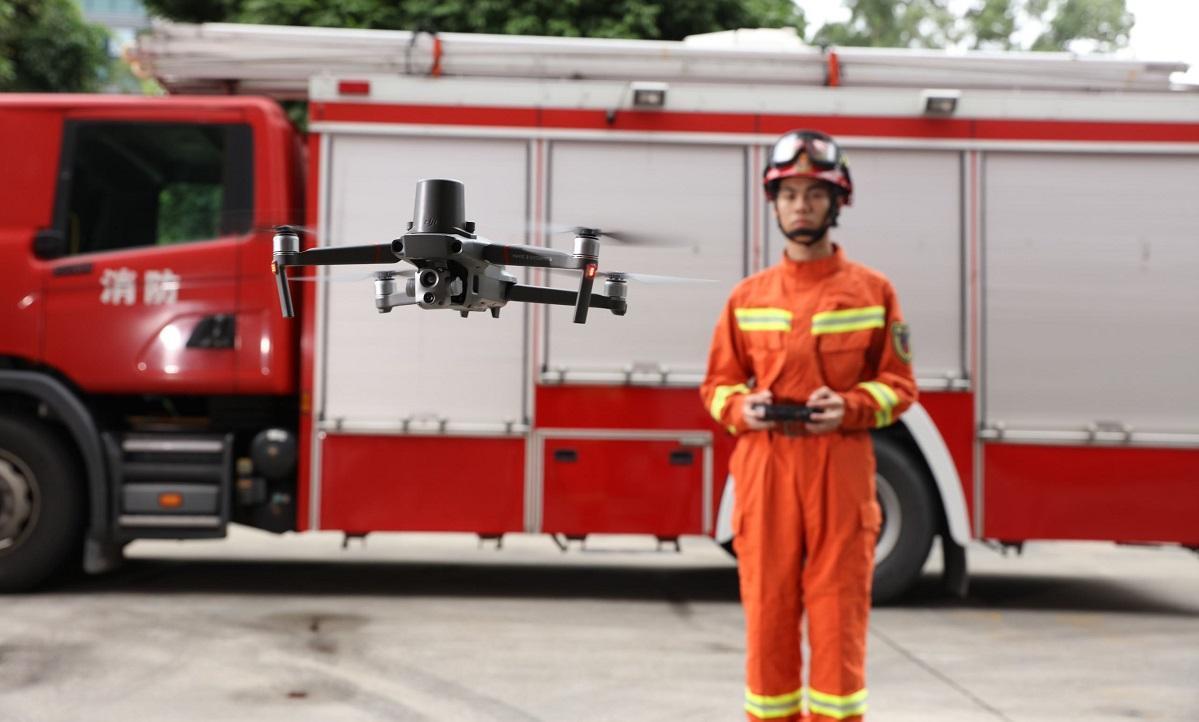
Various crisis and rescue situations require quick response and swift action. Especially in search and rescue operations, accurate location information is of utmost importance to ensure that aid can be directed as effectively as possible to the right place. research According to aerial photography, as of now, a total of 500 people have been located and found worldwide.
DJI Mavic 2 Enterprise Advanced is the first small-sized aerial photography drone designed for demanding work and crisis situations, featuring a high-quality video camera, precise thermal camera, and an efficient RTK measurement device. In addition to hobby-grade aerial photography drones, the world's leading drone manufacturer DJI has brought a tool for professional and commercial use that can accurately measure location data and temperatures, as well as capture high-quality video footage. Accurate photography is also easy to achieve.
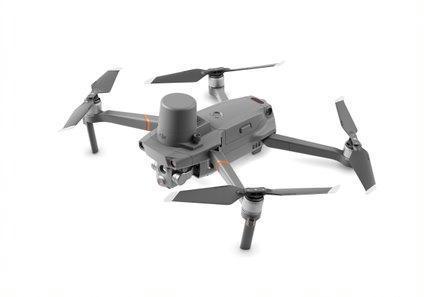
Real-time kinematic (RTK) technology helps with positioning because its accuracy is up to the centimeter level. The technology is based on GPS satellite positioning, but it makes positioning more accurate than conventional GPS positioning.
The copter’s thermal camera can detect temperatures with an accuracy of up to two degrees Celsius, and the resolution of temperature differences is even less than 0.05 degrees Celsius. This is of great help not only in search operations but also in various accident situations where determining the maximum or minimum temperature is important. The thermal camera sensor with 640 × 512 pixels resolution and the 48-megapixel imaging camera with a half-inch CMOS sensor work together to make the copter an extremely convenient and accurate observation tool. The copter user can also choose which shooting mode to use in a given situation. Additionally, it is possible to monitor both modes simultaneously.
The video can be captured by the copter with impressive 4K ultra-high-definition resolution. Thanks to 32-times digital zoom and 16-times thermal camera zoom, both shooting modes are capable of precise imaging from a safe operating distance.
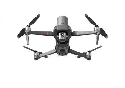
Thanks to the RTK positioning module, the helicopter can be determined with an accuracy of almost one centimeter. In addition, the helicopter uses the NTRIP protocol to efficiently transmit the positioning data. The helicopter can be programmed to navigate between up to 240 different stages. This allows, among other things, for various inspection flights, for example near power lines. The helicopter has 24 gigabytes of storage space for photos and videos. In addition, the helicopter uses efficient AES-256 encryption technology, so all the data collected and transmitted by the helicopter is highly protected, even if the helicopter falls into the wrong hands.
Thanks to its powerful and intelligent flight features, the DJI Mavic 2 Enterprise Advanced is able to fly with precision around obstacles. The drone can even fly for 31 minutes on a full charge and reach a top speed of 72 kilometers per hour. The OcuSync 2.0 transmission technology ensures reliable control between the drone and the controller even at a distance of several kilometers.
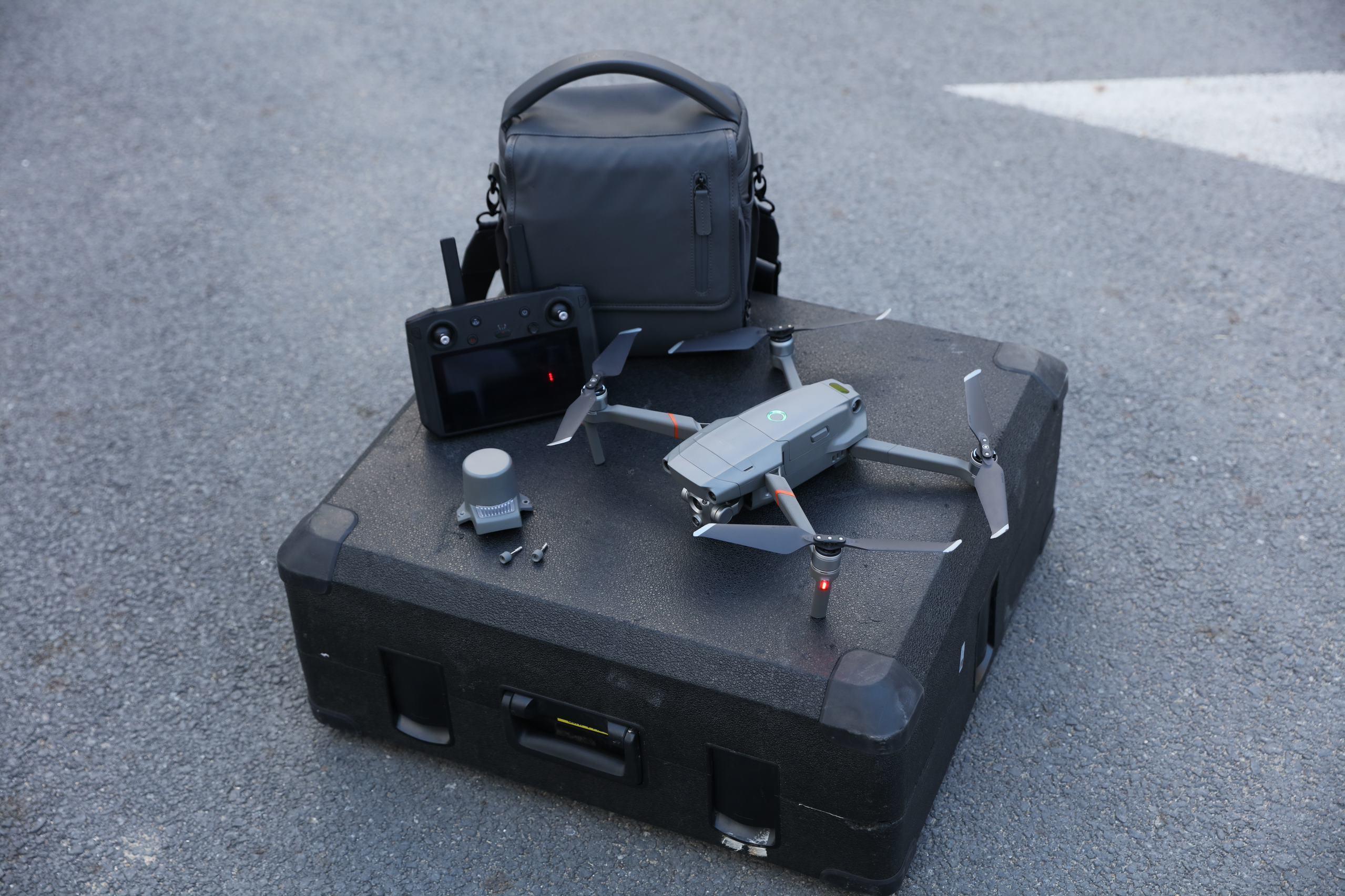
When needed, the drone can be expanded with various auxiliary devices. These include a light emitter with a brightness of 2,400 lumens, a speaker that plays sound with a volume of up to 100 decibels, a strobe light (carrying capacity up to 4.8 kilometers) that meets the standards of the U.S. Environmental Protection Agency, and the DJI Smart Controller.
Recommended price: 7000 euros (price includes RTK positioning module)
Further information: dji.com/fi/mavic-2-enterprise-advanced
Importer: boston.dk
Most read today
Latest
Subscribe to the newsletter
Subscribe to our newsletter and stay up to date with the latest news in technology and entertainment electronics.
Survey
Quiz
Nokia phones
Related Posts
Philips The Roller and The Tube – Moving sound with its own style
Philips The Roller and The Tube bring back the 1980s boombox spirit without cassettes or radio. It comes with Bluetooth, a battery, Auracast, and...

QUESTION: How much are you willing to pay for a phone?
The development of phones has also changed the differences in price categories. Previously, features seen only in expensive models are now found in even cheaper phones. Therefore, the question is not...
Cayin Jazz 70 – genuine tube sound and style at a reasonable price
The tube amplifier doesn't need to cost several thousand euros. The new Jazz 70 from Cayin brings classic EL34 tube technology, visible tubes, analog meters, and hand-crafted controls...

The use of artificial intelligence in music is growing rapidly, but there is still a lot to be learned about its use – at least in Finland.
Artificial music evokes significantly more reservations in Finns than the use of artificial intelligence in general. Artificial intelligence is rapidly becoming a part of everyday life, but the output it produces...
The new arrival of CDs is also reflected in devices – the Argon Audio CD1 is a new CD player priced at 399 euros
The arrival of vinyl records has been ongoing for a long time, and now a similar trend is also evident in CD records. Argon Audio responds to this interest with the new CD1 player,...

Audio-Technica ATH-AL5NC combines an open design and wireless connectivity – battery life up to 75 hours
Audio-Technica expands its range of open headphones with the ATH-AL5NC model, which is the manufacturer's first wireless open headphone. In addition to Bluetooth connectivity, it also features LDAC, noise reduction, and sound leakage...
 Suomi
Suomi  English